
Editor’s Note: I was hoping to begin this third and final part of my water series with a catchy intro, but I can’t think of one, so will simply dive right in. (Dive? Water? Does that count as catchy?)
In 2010, the Canadian Council of Ministers of the Environment issued a report — “Review and Assessment of Canadian Groundwater Resources, Management, Current Research Mechanisms and Priorities” — bemoaning our lack of groundwater knowledge:
The lack of recognition of the value of groundwater as a resource was a repeatedly raised theme. Groundwater is considered to be out-of-sight, poorly understood and expensive to investigate. Unlike other natural resources, its resource potential is largely unknown and there is relatively little pricing associated with groundwater. As a result, there has been little incentive to manage the resource effectively.
This jibes with the fact that got me thinking about groundwater in the first place: the low price at which many North American municipalities are selling it to bottled water companies like Nestlé (a phenomenon I explored in Part I of this series.)
Measuring and mapping groundwater is an expensive and time-consuming undertaking but one that we have been (slowly) tackling in this country.
Taking inventory
As with so many things in Canada, jurisdiction over groundwater resides mostly with the provinces but, given that water is no respecter of borders (provincial or international), the feds also claim some jurisdiction over it, chiefly via the Departments of Natural Resources (NRCan) and Environment and Climate Change.
In fact, in 2002, Natural Resources Canada launched a Groundwater Geoscience Program (GGP) to:
…address the need for information to support groundwater resource management by filling the knowledge gaps on groundwater supply as well as on the sustainable use of the resource.
This was, of course, two years after the 2000 E.-coli outbreak in Walkerton, Ontario which killed six people and sickened 2,000. The outbreak was blamed on manure-contaminated water from a cattle farm infiltrating the wells supplying the town’s drinking water. The case, I don’t think it’s an exaggeration to say, made Canadians keenly aware of groundwater. That, combined with increasing concern about the potential effects of climate change on water supplies, meant their was a public appetite for research.

Some of the aquifers mapped by the Geological Study of Canada.
The GGP included a Canadian Groundwater Inventory which identified 30 “key” aquifers for assessment. By 2013, a federal review of the GPP would state that:
Good progress has been made on assessing and characterizing aquifers. The GGP is on track to assessing 19 of the 30 aquifers by the end of 2013-14, as planned. Based on this pace, GSC expects the inventory of 30 aquifers to be complete by 2025.
I was interested to know how things stood as of 2019, so I contacted the Department of Natural Resources and had a chance to speak to Yves Michaud, a geoscience manager with the Geological Survey of Canada based in Quebec. (As in, I was able to phone him and speak to him.)
He told me that at some point after that 2013 evaluation, they realized that if they stuck to their original plan of mapping, in detail, each of the 30 aquifers they were “never going to finish.” In the end, they managed to complete work on 22 aquifers — in part by looking at three aquifers in Southern Ontario on a “supra-regional” scale. (Michaud noted that they were helped in Ontario by the wealth of groundwater data collected in that province post-Walkerton.)
Michaud says another goal of the program was to learn how best to approach groundwater research in the country’s various regions and terrains and to serve as a repository of such information for the provinces which, it is hoped, will continue the work of mapping and measuring groundwater. On the list of provinces that seem to be doing so, Michaud includes Ontario (which, as noted, has already done a lot of work gathering hydrogeological data), Quebec (which launched its own mapping program in 2008), British Columbia (which was already a leader in the area, even prior to 2000), Alberta (the most water-stressed province in the country) and even Nova Scotia, which he said has been building on the research done here as part of the groundwater inventory: namely, the Annapolis-Cornwallis Valley Aquifer Study, which was completed in 2012 and is available on the Nova Scotia Environment Department website.

Cornwallis River near low tide, 2007. (Photo by Wikijessie, Public Domain, via Wikimedia Commons)
Writing in 2005 (at which point, the groundwater inventory had covered 12 Canadian aquifers, including the Annapolis-Cornwallis Valley Aquifer), Alfonso Rivera, chief hydrogeologist with the Geological Survey of Canada, said:
None of the twelve regional-scale assessments revealed declines in groundwater levels. In general, Canadian regional aquifers cannot be compared to regional aquifers in the US, many of which are either fully developed or overdeveloped (i.e., discharge is greater than recharge), such as the Ogallala in the High Plains or the San Joaquin Valley in California.
An important decline of groundwater level has been documented in only one aquifer in Canada (which was not part of the GSC regional aquifer assessments). In the Estevan Valley aquifer in southern Saskatchewan, the water level in the aquifer was locally lowered by more than 45 metres (and by nearly 20 metres as much as 20 kilometres away) by a field of pumps extracting water for electricity generation. However, this drop is a local decline. Pumping was halted in 1994. While the pumping was originally thought to be well within the sustainable yield of the aquifer, further studies suggest the water level in the aquifer will take up to 20 years to fully recover. There could be other instances of overexploited aquifers in Canada, perhaps at local scales, but the current information as synthesized by the GSC has not identified any.
Which is good news, clearly, but Rivera went on:
But on the other hand, the lack of detailed data and information severely hinder the application of best water management practices, in particular practices for water takings and interactions between surface water, groundwater, and aquatic and terrestrial habitats. The limited current knowledge is the main obstacle to improving groundwater regulation.
I’m going to break that down into two final sections — groundwater regulation (here in Nova Scotia) and “limited current” knowledge of groundwater.
Permit me
In this province, government approval is required to extract more than 23,000 liters or 5,000 gallons of groundwater per day. I spoke to Jennifer MacDonald, a regional hydrogeologist with Environment Nova Scotia’s inspection, compliance and enforcement division based in Truro, who pointed me to the “Guide to Groundwater Withdrawal Approvals” on the department website, then walked me through the process, which involves the applicant hiring a professional — a geoscientist or a hydrogeologist — to do an assessment:
[T]hat assessment involves what we call pumping tests, so they pump water out of the well and then they monitor for a period of, most often, 72 hours…They measure water levels in the well very frequently over those 72 hours and then they’re able to model that information and graph it and it gives them an idea how much water is available at that particular location. And it also allows them to look at potential impact on other water users that might be in the area, so if there’s another well nearby that somebody’s using for a different purpose, they can understand if there is interference between the two supplies then they can also, if there’s a water course nearby, they can look at that to see if there’s going to be any potential impacts on that water course. So the process is very detailed.
In a 2005 report called “Buried Treasure: Groundwater Permitting and Pricing in Canada,” Linda Nowlan gave our permitting process good marks:
Nova Scotia’s criteria are found in the Guide to Groundwater Withdrawal Approvals, and include the submission of a hydrogeological study that clearly evaluates the potential effects of the proposed withdrawal on existing groundwater users and the environment. The criteria often include environmental considerations.
Permit holders are charged for water in Nova Scotia, here’s the applicable clause of the Environment Act:
Water licences for municipal, recreational, industrial and domestic purposes:
| Minimum fee: The minimum fee for a water licence shall be $53.25, unless as otherwise provided under Sections 1 and 2(iv). | |
| Annual fee calculation: The licence fee shall be derived by summing the subtotals calculated as follows: | |
| For each million litres per day, up to 2 million litres per day | $117.15 |
| For each additional million litres per day over 2 million litres per day, up to 9 million litres per day | $122.47 |
| For each additional million litres per day over 9 million litres per day, up to 27 million litres per day | $133.12 |
| For each additional million litres per day over 27 million litres per day, up to 90 million litres per day | $138.45 |
| For each million litres per day over 90 million litres per day | $143.77 |
I asked MacDonald if the province monitors how much water permit-holders are actually taking and she said:
[O]nce the approval is issued, the approval holders are required to monitor how much water they’re taking and to report that to us on a regular basis.
I’m always skeptical of any system dependent on industry “self-reporting” so I asked if there were any other measures in place to ensure limits were not being exceeded and MacDonald said they had an auditing process but she wasn’t able to answer questions about it. I asked government spokesperson Rachel Boomer how many inspectors the province employed for water audits and how often audits took place. She told me by email:
There are 62 inspector specialists employed by the province who conduct audits. We have 352 active water withdrawal approvals in our system. We do regular audits on a schedule based on risk. We also audit if there is a complaint. If anyone has a complaint, we encourage them to call us.
First, I suspected those 62 “inspector specialists” were not dedicated to water-use monitoring and in answer to a follow-up question, Boomer confirmed my suspicions:
The 62 inspector specialists support other projects in addition to water use monitoring.
And second, “We do regular audits on a schedule based on risk” is not the answer to my question which was, “How often are audits conducted?”
So I asked again and Boomer told me:
Audit schedule is based on risk. We’d schedule more frequent audits for a permit holder with compliance issues; less for those without. It’s not a set schedule.
I still have no idea how often audits happen, but I now know there are permit holders with compliance issues, so that’s something, I guess.
Detail from “Estimation of Regional Groundwater Budgets,” Province of NS publication, 2010.
The other side of this coin, though, is that the government apparently does not track groundwater use under 5,000 gallons per day, which could add up to considerable groundwater use.
This reminded me of something I’d read earlier in my research — it’s part of this “Estimation of Regional Groundwater Budgets in Nova Scotia’ chart, created in 2010 (based, judging by the footnotes, on information gathered as part of the Annapolis Valley aquifer study). The objective of the work was to:
…develop preliminary groundwater budgets at the regional scale, highlight potential sustainability issues at the local and site scale, and to make recommendations for an appropriate scientific framework to identify groundwater sustainability concerns.
You’ll want to expand it to read it:
ofi_2010-002_dp
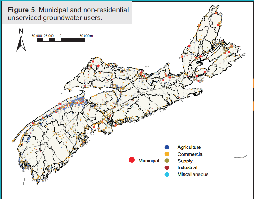
To develop these budgets, the researchers required two “major” pieces of information: estimated recharge to bedrock aquifers from precipitation and estimated groundwater use. Estimates for groundwater use by non-residential unserviced groundwater users (of which there were approximately 3,000, divided into agriculture, commercial, industrial and miscellaneous users) were calculated “by methods ranging from flow records (1% of users) to typical use figures for a given type of facility (55% of users).”
Elsewhere on the same chart, the authors refer to the “high uncertainty with respect to groundwater usage (number of users, location and flow rates).”
This seems like a significant gap in our understanding of groundwater use. Which leads nicely into my final section…
Known Unknowns (Revisited)
I get (insofar as a non-hydrogeologist/non-departmental budget officer can) that mapping aquifers, monitoring surface water, testing rain chemistry, etc, etc, etc, is expensive. But that “Buried Treasure” report I cited earler opens with a quote from a former assistant deputy minister at Environment Canada, Karen Brown, that helps put that expense in perspective. Brown told the Standing Committee on Environment in 2004:
The oil and gas reservoirs in this country are better understood than the groundwater reservoirs, as you all know.
Even in cash-strapped Nova Scotia, we’ve come up with the dosh to map onshore petroleum resources and mineral resources for the benefit of industry. This is, also, presumably, expensive work.
These articles I’ve written this week took me hours to research and yet are laughable, in terms of their scope — and don’t even get me started on their depth.
ofm_2010-002_s4_dpGeological Resource Atlas, Mineral Occurences and Deposits, (Government of Nova Scotia)
But I have a good excuse: even the hydrogeologists don’t know all the answers, as you can see in this final word, which I’m going to give to Alfonso Rivera, chief hydrogeologist of the Geological Survey of Canada (GSC). Writing in 2005, he said:
The regional aquifer assessments will continue with collaboration between federal and provincial governments; however, it is not likely that a comprehensive national inventory of all the groundwater resources of Canada will be produced in the foreseeable future. Some provinces may advance faster and with more complete assessments and inventory of groundwater at the provincial level, whereas others will lag behind, not because of lack of will, but perhaps because of lack of funding and expertise. It has become clear that due to financial restrictions, the requirement for multidisciplinary expertise, and the interjurisdictional nature of groundwater, no single agency or department in Canada is capable of such an endeavour and commitment. The GSC should continue to provide strong, effective, and sustained leadership in this area.The GSC assessments and inventory are a good but modest start.
Canada cannot be compared to the US where a large number of regional aquifers are overdeveloped, as in Canada most aquifers are in pre-development conditions. However there are lessons to be learned from our southern neighbour. Knowledge of the identification, assessment, and inventory of the groundwater resources of Canada is a prerequisite to avoid catastrophes of the same nature as those in the US.We should take advantage of the pre-development conditions that seem to prevail in Canada to assess our aquifers before it is too late.


